Namibia
History & Safari Information
HISTORY OF NAMIBIA
Early History and Colonialism
The earliest inhabitants
of Namibia were the bushmen (or San) hunters and gatherers, who lived there
as
early
as
2,000 years ago. Later inhabitants include
the Nama and the Damara or Berg Dama. The Bantu-speaking Ovambo and Herero
migrated from the north in about the 14th century A.D. By c.AD 500, Nama
herders had entered the region; they have left early records of their
activities in the form of cave
paintings. The Herero people settled in the western and northern areas of Namibia
around 1600. The Ovambo migrated into Namibia after about 1800.
The inhospitable Namib Desert constituted
a formidable barrier to European exploration until the late 18th century,
when successions of travelers,
traders, hunters, and missionaries explored the area. Diogo Cam and Bartolomeu
Dias, both Portuguese navigators, landed on the coast in the early
15th cent. Portuguese and Dutch expeditions explored the coastal regions,
and in the late 18th cent. Dutch and British captains laid claim to
parts of the coast. These claims, however, were disallowed by their
governments. In the 18th cent., English missionaries arrived, and they
were followed by German missionaries in the 1840s.
In 1878,
the United Kingdom annexed Walvis Bay on behalf of Cape Colony, and
the area was
incorporated into the Cape of Good Hope in 1884. In 1883, a German trader,
Adolf Luderitz, claimed the rest of the coastal region after negotiations
with a local chief. Negotiations between the United Kingdom and Germany
resulted in Germany's annexation of the coastal region, excluding Walvis
Bay. The following year, the United Kingdom recognized the hinterland
up to 20 degrees east longitude as a German sphere of influence. A region,
the Caprivi Strip, became a part of South West Africa after an agreement
on July
1, 1890, between the United Kingdom and Germany. The British recognized
that the strip would fall under German administration to provide access
to the Zambezi River and German colonies in East Africa. In exchange,
the British received the islands of Zanzibar and Heligoland. German colonial
power was consolidated, and prime grazing land passed to white control
as a result of the Herero and Nama wars of 1904-08. German administration
ended during World War I following South African occupation in 1915.
On December 17, 1920, South Africa undertook
administration of South West Africa under the terms of Article 22 of
the Covenant of the League
of Nations and a mandate agreement by the League Council. The mandate
agreement gave South Africa full power of administration and legislation
over the territory. It required that South Africa promote the material
and moral well being and social progress of the people. When the League
of Nations was dissolved in 1946, the newly formed United Nations inherited
its supervisory authority for the territory. South Africa refused UN
requests to place the territory under a trusteeship agreement. During
the 1960's, as the European powers granted independence to their colonies
and trust territories in Africa, pressure mounted on South Africa to
do so in Namibia, which was then South West Africa. In 1966, the UN General
Assembly revoked South Africa's mandate. Also in 1966, the South West
Africa People's Organization (SWAPO) began guerrilla attacks on Namibia,
infiltrating the territory from bases in Zambia. After Angola became
independent in 1975, SWAPO established bases in the southern part of
the country. Hostilities intensified over the years, especially in Ovamboland.
In a 1971 advisory opinion, the International Court of Justice upheld
UN authority over Namibia, determining that the South African presence
in Namibia was illegal and that South Africa therefore was obligated
to withdraw its administration from Namibia immediately. The Court also
advised UN member states to refrain from implying legal recognition or
assistance to the South African presence.
International Pressure for Independence
In 1977, Western members of the UN Security Council, including Canada,
France, the Federal Republic of Germany, the United Kingdom, and the
United States (known as the Western Contact Group), launched a joint
diplomatic effort to bring an internationally acceptable transition to
independence for Namibia. Their efforts led to the presentation in April
1978 of Security Council Resolution 435 for settling the Namibian problem.
The proposal, known as the UN Plan, was worked out after lengthy consultations
with South Africa, the front-line states (Angola, Botswana, Moçambique,
Tanzania, Zambia, and Zimbabwe), SWAPO, UN officials, and the Western
Contact Group. It called for the holding of elections in Namibia under
UN supervision and control, the cessation of all hostile acts by all
parties, and restrictions on the activities of South African and Namibian
military, paramilitary, and police.
South Africa agreed to cooperate in achieving the implementation of
Resolution 435. Nonetheless, in December 1978, in defiance of the UN
proposal, it unilaterally held elections in Namibia which were boycotted
by SWAPO and a few other political parties. South Africa continued to
administer Namibia through its installed multi-racial coalitions. Negotiations
after 1978 focused on issues such as supervision of elections connected
with the implementation of the UN Plan.
Negotiations and Transition
Intense discussions between the concerned parties continued during the
1978-88 period, with the UN Secretary General's Special Representative,
Martti Ahtisaari, playing a key role. The 1982 Constitutional Principles,
agreed upon by the front-line states, SWAPO, and the Western Contact
Group created the framework for Namibia's democratic constitution. The
U.S. Government's role as mediator was critical throughout the period,
one example being the intense efforts in 1984 to obtain withdrawal of
South African defense forces from Southern Angola.
In May 1988, a U.S. mediation team, headed by Assistant Secretary of
State for African Affairs Chester A. Crocker, brought negotiators from
Angola, Cuba, and South Africa, and observers from the Soviet Union together
in London. Intense diplomatic maneuvering characterized the next 7 months,
as the parties worked out agreements to bring peace to the region and
make implementation of UN Security Council Resolution 435 possible. On
December 13, Cuba, South Africa, and the People's Republic of Angola
agreed to a total Cuban troop withdrawal from Angola. The protocol also
established a Joint Commission, consisting of the parties with the United
States and the Soviet Union as observers, to oversee implementation of
the accords. A bilateral agreement between Cuba and the People's Republic
of Angola was signed in New York on December 22, 1988. On the same day
a tripartite agreement, in which the parties recommended initiation of
the UN Plan on April 1 and the Republic of South Africa agreed to withdraw
its troops, was signed. Implementation of Resolution 435 officially began
on April 1, 1989, when South African-appointed Administrator General
Louis Pienaar officially began administrating the territory's transition
to independence. Special Representative Martti Ahtisaari arrived in Windhoek
to begin performing his duties as head of the UN Transition Assistance
Group (UNTAG).
The transition got off to a shaky start on April 1 because, in contravention
to SWAPO President Sam Nujoma's written assurances to the UN Secretary
General to abide by a cease-fire and repatriate only unarmed insurgents,
approximately 2,000 armed members of the People's Liberation Army of
Namibia (PLAN), SWAPO's military wing, crossed the border from Angola
in an apparent attempt to establish a military presence in northern Namibia.
The special representative authorized a limited contingent of South African
troops to aid the South West African police in restoring order. A period
of intense fighting followed, during which 375 PLAN fighters were killed.
At Mt. Etjo, a game park outside Windhoek, in a special meeting of the
Joint Commission on April 9, a plan was put in place to confine the South
African forces to base and return PLAN elements to Angola. While the
problem was solved, minor disturbances in the north continued throughout
the transition period. In October, under order of the UN Security Council,
Pretoria demobilized members of the disbanded counterinsurgency unit,
Koevoet (Afrikaans for crowbar), who had been incorporated into the South
West African police. The 11-month transition period went relatively smoothly.
Political prisoners were granted amnesty, discriminatory legislation
was repealed, South Africa withdrew all its forces from Namibia, and
some 42,000 refugees returned safely and voluntarily under the auspices
of the Office of the UN High Commissioner for Refugees (UNHCR). Almost
98% of registered voters turned out to elect members of the constituent
assembly. The elections were held in November 1989 and were certified
as free and fair by the special representative, with SWAPO taking 57%
of the vote, just short of the two-thirds necessary to have a free hand
in drafting the constitution. The Democratic Turnhalle Alliance, the
opposition party, received 29% of the vote. The Constituent Assembly
held its first meeting on November 21 and its first act unanimously resolved
to use the 1982 Constitutional Principles as the framework for Namibia's
new constitution.
By February 9, 1990, the Constituent Assembly had drafted and adopted
a constitution. March 21, independence day, was attended by Secretary
of State James A. Baker III to represent President Bush. On that same
day, he inaugurated the U.S. Embassy in Windhoek in recognition of the
establishment of diplomatic relations. On March 1, 1994, the coastal
enclave of Walvis Bay and 12 offshore islands were transferred to Namibia
by South Africa. This followed three years of bilateral negotiations
between the two governments and the establishment of a transitional Joint
Administrative Authority (JAA) in November 1992 to administer the 300
square mile territory. The peaceful resolution of this territorial dispute,
which dated back to 1878, was praised by the U.S. and the international
community, as it fulfilled the provisions of U.N. Security Council 432
(1978) which declared Walvis Bay to be an integral part of Namibia.
(The above was excerpted from U.S.
State Department Background Notes 1995)
 Top Top  Return
to Safari Camps & Map of Namibia Return
to Safari Camps & Map of Namibia
GENERAL INFORMATION ON NAMIBIA
Political Summary
South Africa occupied the German colony of South-West
Africa during World War I and administered it as a mandate until after
World War II when it annexed the territory. In 1966 the Marxist South-West
Africa People's Organization (SWAPO) guerrilla group launched a war of
independence for the area that was soon named Namibia, but it was not
until 1988 that South Africa agreed to end its administration in accordance
with a UN peace plan for the entire region. Independence came on 21 March,
1990.
Geography
Namibia is situated in Southern
Africa, bordering the South Atlantic Ocean, between Angola and South
Africa. The total area
of the country is 825,418 sq km or slightly more than half the size of
Alaska. Its coastline is 1,572 km in length. It shares borders with the
following countries: Angola 1,376 km, Botswana 1,360 km, South Africa
967 km, Zambia 233 km.
It is quite notable that Namibia was the first
country in the world to incorporate
the protection
of the
environment
into its constitution;
some 14% of
the
land is protected,
including virtually
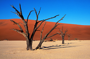
the entire Namib Desert coastal strip. The terrain
is mostly high plateau; Namib Desert along the coast and the Kalahari Desert
in east.
The
capital city of Namibia is Windhoek.
Ethnicity and
Population
The population of Namibia
is estimated at 2.09 million (July 2008). Note:
estimates for this country explicitly take into account the effects
of excess mortality due to AIDS; this can result in lower life expectancy,
higher infant mortality and death rates, lower population and growth
rates, and changes in the distribution of population by age and sex
than would otherwise be expected. It
is estimated that 21.3% of the adult population (210,000 Namibians)
are living with HIV/AIDS (2001 est.) and that 16,000 per year die
from the disease (2003 est.).
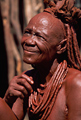
Namibia's ethnicity is as follows:
black 87.5%, white 6%, mixed 6.5%.
Approximately 50% of the population belong to the Ovambo tribe and
9% to the Kavangos tribe; other ethnic groups are: Herero 7%, Damara
7%,
Nama
5%, Caprivian 4%, Bushmen 3%, Baster 2%, Tswana 0.5%. Eighty to ninety
percent of the population are Christian (Lutheran 50% at least),
with the remaining 10% to 20% indigenous beliefs. Languages in
Namibia are as follows: English 7% (official), Afrikaans common language
of most of the population and
about
60% of
the white population, German 32%, indigenous languages: Oshivambo, Herero,
Nama.
Government
Namibia is a republic democracy governed under a legal system based on
Roman-Dutch law and their 1990 constitution.
Chief of state: President Hifikepunye
POHAMBA (since 21 March 2005).
Head of government: Prime Minister Nahas ANGULA
(since 21 March 2005)
Cabinet: appointed by the president from among the members of the National
Assembly.
Elections: president elected by popular vote for
a five-year term (eligible for a second term); election
last held 15 November 2004 (next to be held in November
2009).
The Flag
 The
National flag has a large blue triangle with a yellow sunburst which
fills the upper left section and an equal green triangle (solid) which
fills the
lower
right section; the triangles are separated by a red stripe that is
contrasted by two narrow white-edge borders. Red - represents Namibia's
most important resource, its people. It refers to their heroism and
their determination to build a future of equal opportunity for all;
White - refers to peace and unity; Green - symbolizes vegetation and
agricultural resources; Blue - represents the clear Namibian sky and
the Atlantic Ocean, the country's precious water resources and rain;
and the golden-yellow sun represents life and energy. The
National flag has a large blue triangle with a yellow sunburst which
fills the upper left section and an equal green triangle (solid) which
fills the
lower
right section; the triangles are separated by a red stripe that is
contrasted by two narrow white-edge borders. Red - represents Namibia's
most important resource, its people. It refers to their heroism and
their determination to build a future of equal opportunity for all;
White - refers to peace and unity; Green - symbolizes vegetation and
agricultural resources; Blue - represents the clear Namibian sky and
the Atlantic Ocean, the country's precious water resources and rain;
and the golden-yellow sun represents life and energy. |
Climate  For
temperature and rainfall details in Windhoek and Swakopmund, click African
Safari Weather For
temperature and rainfall details in Windhoek and Swakopmund, click African
Safari Weather
Desert; hot, dry;
rainfall sparse and erratic.
Industry
The chief industries in Namibia are meatpacking, fish
processing, dairy products and mining (diamond, lead, zinc, tin, silver,
tungsten, uranium, copper).
Namibia's natural resources include diamonds,
copper, uranium, gold, lead, tin, lithium,
cadmium, zinc, salt, vanadium, natural gas, hydropower, and fish.
It is also suspected that the country contains deposits of oil, coal, and iron
ore.
Economy
The economy is heavily dependent on the extraction and
processing of minerals for export. Mining accounts for 8% of GDP, but provides more than 50% of foreign exchange earnings. Rich
alluvial diamond deposits make Namibia a primary source for gem-quality
diamonds. Namibia is the fourth-largest exporter of nonfuel minerals
in Africa, the world's fifth-largest producer of uranium, and the producer
of large quantities of lead, zinc, tin, silver, and tungsten. The mining
sector employs only about 3% of the population while about half of the
population depends on subsistence agriculture for its livelihood. Namibia
normally imports about 50% of its cereal requirements; in drought years
food shortages are a major problem in rural areas.
A high per capita
GDP, relative to the region, hides the world's worst inequality of income
distribution.
The currency is the Namibian Dollar.
Recent historical exchange rates are as follows: Namibian dollars per
US dollar - 9.4702 (12/31/2008); 6.6773 (12/31/2007); 7.1255 (12/31/2006); 6.3500 (12/31/2005); 5.7828 (12/31/2004);
6.6957 (12/31/2003); 8.7294 (2002); 11.9650
(12/31/2001); 9.0900 (12/31/2000); 6.1600 (12/31/1999); 5.8975
(12/31/1998); 4.8650
(12/31/1997). The Namibian economy is closely linked to South Africa,
with the Namibian dollar pegged one-to-one to the South African rand.
Privatization of several enterprises
in coming years may stimulate long-run foreign investment. Increased
fish production and mining of zinc, copper, uranium, and silver spurred
growth in 2003-06.
International
Disputes
• Concerns from international
experts and local populations over the Okavango Delta ecology in
Botswana and human displacement scuttled Namibian plans to construct
a hydroelectric dam on Popa Falls along the Angola-Namibia border.
• Managed
dispute with South Africa over the location of the boundary in
the Orange River.
• Namibia has supported, and in 2004 Zimbabwe dropped
objections to, plans between Botswana and Zambia to build a bridge
over the Zambezi River, thereby de facto recognizing a short, but
not clearly delimited, Botswana-Zambia boundary in the river.
Top
Return to Safari Camps & Map of
Namibia
For information about the National Parks of Namibia, click Nam
Parks
|