|
HISTORY OF BOTSWANA
Early History
Khoesan-speaking
hunters and herders, people speaking Khoesan (Khoe and San) languages,
have lived in Botswana for many thousands of years. A site in the Tsodilo
hills (Depression Shelter), in the north-western corner of Botswana, contains
archaeological evidence of continuous Khoesan occupation from about 17
000 BC. to about 1650 AD.
For most of that period Khoesan
people subsisted as hunters and gatherers, their tools made of stone (and
wood and bone), with a culture characterized by archaeologists as 'Later
Stone Age'. Their hunting and gathering lifestyle was adapted to seasonal
mobility in family groups over grassland and scrub, in and around the
extensive riverine lakes and wetlands that once covered the north of the
country and were dotted elsewhere.
During the last centuries BC many Khoe-speaking
people in northern Botswana converted their lifestyle to pastoralism -
herding cattle and sheep on the rich pastures exposed by the retreating
wetlands of the Okavango delta and Makgadikgadi lakes. Cattle and sheep
had been brought from East Africa, where they had previously been herded
by other "Later Stone Age" people for thousands of years.
Some Khoe pastoralists migrated with their
livestock through central Namibia as far south as they could, to the Cape
of Good Hope, by about 70BC. They took Khoe language to areas where only
San languages had previously been spoken.
Early
Chiefdoms
From about 850 AD farmers from the upper Zambezi,
ancestral to the Mbukushu and Yeyi peoples, reached as far south and west
as the Tsodilo hills (Nqoma). Oral traditions tell of Yeyi farmers and
fishermen scattering among the Khoesan of the Okavango delta in the early
18th century, like 'flies across a milk-pail'. The oral traditions of
Mbukushu chiefs tell of migrations from the upper Chobe down the Okavango
river later in the 18th century. These appear to have been responses to
increased raiding in Angola for the Atlantic slave trade. The oral traditions
of Herero and Mbanderu pastoralists, south-west of the Okavango straddling
the Namibia border, relate how they were split apart from their Mbandu
parent stock by 17th century Tswana cattle-raiding from the south.
Tswana Dynasties
The main Tswana (Central Sotho) dynasties of the
Hurutshe, Kwena and Kgatla were derived from the Phofu dynasty, which
broke up in its western Transvaal home in the 1500-1600 period. Oral traditions
usually explain these migrations as responses to drought, with junior
brothers breaking away to become independent chiefs. The archeology of
the Transvaal shows that the farming population was expanding and spreading
in small homesteads, each clustered round its cattle corral, across open
countryside - with a few larger settlements as evidence of petty chiefdoms.
But after about 1700 the settlement pattern changed, with stone-walled
villages and some large towns developing on hills - evidence of the growth
of states often hostile to each other. These states were probably competing
for cattle wealth and subject populations, for control of hunting and
mineral tribute, and for control of trade with the east coast.
Kwena and Hurutshe migrants
founded the Ngwaketse chiefdom among Khalagari-Rolong in south-eastern
Botswana by 1700. After 1750 this grew into a powerful military state
controlling Kalahari hunting and cattle raiding, and copper production
west of Kanye. Meanwhile other Kwena had settled around Molepolole; and
a group of those Kwena henceforth called Ngwato further north at Shoshong.
By about 1770 a group of Ngwato, called the Tawana, had even settled as
far north-west as Lake Ngami, in country occupied by Yeyi and previously
frequented by Khalagari-Rolong and Kwena hunters and traders.
Wars in Southern Africa
Southern Africa as a whole
saw an increasing tempo of disruption, migration and war from about 1750
onwards, as trading and raiding for ivory, cattle and slaves spread inland
from the coasts of Moçambique, the Cape Colony and Angola. By 1800 raiders
from the Cape had begun to attack the Ngwaketse. By 1826 the Ngwaketse
were being attacked by the Kololo, an army of refugees under the dynamic
leadership of Sebetwane, who had been expelled north- westwards, possibly
by raiders from Maputo Bay. The great Ngwaketse warrior king, Makaba II,
was killed, but the Kololo were pushed further north by a counter-attack.
The Kololo moved through Shoshong, expelling
the Ngwato northwards, to the Boteti River, where they settled for a number
of years - attacking the Tawana and raiding for cattle as far west as
Namibia, where they were warded off in a battle with Herero. In about
1835 they settled on the Chobe River, from which the Kololo state stretched
northwards until its final defeat by its Lozi subjects on the upper Zambezi
in 1864. Meanwhile the Kololo were followed in their tracks by the Ndebele,
a raiding army led by Mzilikazi, who settled in the Butua area of western
Zimbabwe in 1838-40 after the conquest of the Rozvi. These wars are called
the Difaqane by historians.
Post-War Prosperity
The Tswana states
of the Ngwaketse, Kwena, Ngwato and Ngwato were reconstituted in the
1840s
after the wars passed. The states took firm control of commoners and
subject peoples, organized in wards under their own chiefs paying tribute
to the
king. The states competed with each other to benefit from the increasing
trade in ivory and ostrich feathers being carried by wagons down new
roads to Cape Colony in the south. Those roads also brought Christian
missionaries to Botswana, and Boer trekkers who settled in the Transvaal
to the east of Botswana.
The most remarkable Tswana king of this
period was Sechele (ruled 1829-92) of the Kwena around Molepolole. He
allied himself with British traders and missionaries, and was baptized
by David Livingstone (see Links for link to free electronic text of his
classic Missionary Travels). He also fought with the Boers, who tried
to seize Africans who fled to join Sechele's state from the Transvaal.
But by the later 1870's the Kwena had lost control of trade to the Ngwato,
under Khama III (ruled 1875-1923), whose power extended to the frontiers
of the Tawana in the north-west, the Lozi in the north and the Ndebele
in the north-east.
British Protectorate
The Scramble for Africa
in the 1880s resulted in the German colony of South West Africa, which
threatened to join across the Kalahari with the independent Boer republic
of the Transvaal. The British in Cape Colony responded by using their
missionary and trade connections with the Tswana states to keep the "missionaries'
road" to Zimbabwe and the Zambezi open for British expansion. In
1885 the British proclaimed a protectorate over their Tswana allies, as
far north as the Ngwato; and the protectorate was extended to the Tawana
and the Chobe River in 1890.
British colonial expansion was privatized,
in the form of the British South Africa (BSA) Company, which used the
road through the Bechuanaland Protectorate to colonize Zimbabwe (soon
to be called Rhodesia) in 1890. But the protectorate itself remained under
the British crown, and white settlement remained restricted to a few border
areas, after an attempt to hand it over to the BSA Company was foiled
by the delegation of three Tswana kings to London in 1895. The kings,
however, had to concede to the company the right to build a railway to
Rhodesia through their lands.
The British government continued to regard
the protectorate as a temporary expedient, until it could be handed over
to Rhodesia or, after 1910, to the new Union of South Africa. Hence the
administrative capital remained at Mafeking (Mafikeng), actually outside
the protectorate's borders in South Africa, from 1895 until 1964. Investment
and administrative development within the territory were kept to a minimum.
It declined into a mere appendage of South Africa, for which it provided
migrant labour and the rail transit route to Rhodesia. Short-lived attempts
to reform administration and to initiate mining and agricultural development
in the 1930s were hotly disputed by leading Tswana chiefs, on the grounds
that they would only enhance colonial control and white settlement. The
territory remained divided into eight largely self-administering 'tribal'
reserves, five white settler farm blocks, and the remainder classified
as crown (i.e. state) lands.
The extent of Bechuanaland Protectorate's
subordination to the interests of South Africa was revealed in 1950. In
a case that caused political controversy in Britain and the Empire, the
British government barred Seretse Khama from the chieftainship of the
Ngwato and exiled him for six years. This, as secret documents have since
confirmed, was in order to satisfy the South African government which
objected to Seretse Khama's marriage to a white woman at a time when racial
segregation was being reinforced in South Africa under apartheid.
Botswana's Independence
From the later 1950s
it became clear that Bechuanaland could no longer be handed over to South
Africa, and must be developed towards political and economic self-sufficiency.
The supporters of Seretse Khama began to organize political movements
from 1952 onwards, and there was a nationalist spirit even among older
'tribal' leaders. Ngwato 'tribal' negotiations for the start of copper
mining reached agreement in 1959. A legislative council was eventually
set up in 1961 after limited national elections. The Bechuanaland People's
Party (BPP) was founded in 1960, and the Bechuanaland Democratic Party
(later Botswana Democratic Party, BDP) - led by Seretse Khama - in 1962.
After long resistance to constitutional
advance before economic development could pay for it, the British began
to push political change in 1964. A new administrative capital was rapidly
built at Gaborone. Bechuanaland became self- governing in 1965, under
an elected BDP government under Seretse Khama as prime minister. In 1966
the country became the Republic of Botswana, with Seretse Khama as its
first president.
For its first five years of political
independence, Botswana remained financially dependent on Britain to cover
the full cost of administration and development. The planning and execution
of economic development took off in 1967-71 after the discovery of diamonds
at Orapa. The essential precondition of this was renegotiation of the
customs union with South Africa, so that state revenue would benefit from
rising capital imports and mineral exports - rather than remaining a fixed
percentage of total customs union income. This renegotiation was achieved
in 1969.
Economic and Political Growth
From 1969 onwards Botswana began
to play a more significant role in international politics, putting itself
forward as a non-racial, liberal democratic alternative to South African
apartheid.
South Africa was obliged to step down
from its objections to Botswana building a road, with US aid finance,
direct to Zambia avoiding the old railway and road route through Rhodesia.
From 1974 Botswana was, together with Zambia and Tanzania, and joined
by Moçambique and Angola, one of the "Front Line States" seeking
to bring majority rule to Zimbabwe, Namibia and South Africa.
With an economy growing annually between
12 and 13 percent, Botswana extended basic infrastructure for mining development
and basic social services for its population. More diamond mines were
opened, on relatively favourable terms of income to the state, and less
economically successful nickel-copper mining commenced at Selebi-Phikwe.
The BDP was consistently re-elected with a large majority, though the
Botswana National Front (BNF, founded 1965) became a significant threat
after 1969, when "tribal" conservatives joined the socialists
in BNF ranks attacking the "bourgeois" policies of government.
The later 1970s saw civil war in Rhodesia,
and urban insurrection in South Africa, from which refugees flowed into
Botswana. When Botswana began to form its own army, the Botswana Defence
Force, the Rhodesian army crossed the border and massacred 15 Botswana
soldiers in a surprise attack at Leshoma (February 1978). Botswana played
its part in the final settlement of the Rhodesian war, resulting in Zimbabwe
independence in 1980. But its main contribution was in formulating the
Southern African Development Coordination Conference, to look to the future
of the region.
The idea behind SADCC, as expounded by
Seretse Khama, was to coordinate disparate economies rather than to create
a unified market in southern Africa. All the states of southern Africa,
except South Africa (and Namibia), formed SADCC in 1980, to work together
in developing identified sectors of their economies - particularly the
transport network to the ports of Moçambique.
President Khama Dies
Seretse Khama died in July 1980 and
was succeeded as president by his deputy since 1965, vice-president Quett
(aka Sir Ketumile) Masire.
Between 1984 and 1990 Botswana suffered
from upheavals in South Africa when South African troops raided the 'Front
Line States'. Two raids on Gaborone by the South African army in 1985
and 1986 killed 15 civilians. A new era in regional relations began with
the independence of Namibia in 1990, and continued with internal changes
in South Africa culminating in its free elections of 1994.
The economy continued to expand rapidly
after a temporary slump in diamond and beef exports at the beginning of
the 1980s. The expansion of mining output slowed in the 1990s, but was
compensated for by the growth of manufacturing industry producing vehicles
and foodstuffs for the South African market.
Mogae Succeeds Masire
In April 1998, Quett (Sir Ketumile)
Masire retired as president, and was succeeded by his vice-president Festus
Mogae. Since then the main opposition party, the BNF, which had begun
to approach parity with the ruling BDP in the elections of 1994, has been
split in half by a leadership dispute.
Botswana handed over leadership of SADCC,
now the Southern African Development Community(SADC), to South Africa
in 1994. But the secretariat of SADC remains housed in the capital of
Botswana, Gaborone.
As well as SADC, the Republic of Botswana
is a member of the United Nations, the Organization of African Unity (OAU),
the Non-Aligned Movement, and the Commonwealth. Botswana is also a member
(with Lesotho, Namibia, South Africa, and Swaziland) of the Southern African
Customs Union (SACU).
Mogae Steps Down
Festus Mogae stepped down as President, as he had long said he would do, on April 1, 2008, handing power to Vice President Ian Khama. At his swearing-in ceremony in Gaborone, Khama said that there would be continuity in policy and no "radical changes", although he said that "a change in style and special emphasis on a number of issues" might be evident, and he emphasized his commitment to democracy. The next general election is scheduled for October 2009.
(Portions of the text above were excerpted
from The
Botswana History Pages by Neil Parsons)
GENERAL
INFORMATION ON BOTSWANA
 Top
Top  Return to Map
of Botswana
Return to Map
of Botswana
Geography
Botswana covers 585,370 sq km - approximately
the size of France or Texas. This vast, desolate,
landlocked country is bordered on the south by South Africa, on the
east by Zimbabwe, to the west is Namibia, and to its north lies Namibia
and Zambia (for only 700 metres, the shortest international boundary
in the world).
Ethnicity and
Population
Botswana's population of 1.84 million people (July
2008) is small for a country this size. Botswana has one of
the world's highest known rates of HIV/AIDS infection (adult prevelance
rate of 37.3%, with 350,000 living with the disease - 2003 est.),
with 33,000 deaths per year from the disease (2003 est.), but also
one of Africa's most progressive and comprehensive programs for dealing
with the disease. Because of this high rate of infection, the
life expectancy at birth is 50.16 years (2008 est.). Fortunately,
the political will and the financial resources to tackle the problem
are available. Botswana has introduced the Vision 2016 campaign,
which is aiming to achieve an AIDS-free Botswana by this date.
The
largest ethnic group is Tswana (or Setswana) at 79%, with the remainder
made up of Kalanga 11%, Basarwa 3% and other, which are are largely
nomadic peoples such as the San, Bayei and Hambukushu but also including
whites. The major religions are Christian (72%) and indigenous
beliefs (28%).
English (2.1%) is the official language,
but the majority of the people (78.2%) speak Setswana. Other
languages include Kalanga (7.9%) and Sekgalagadi (2.8%).
Government
Botswana is a parliamentary republic governed under the constitution
of 1966. The president, who is both chief of state and head of government,
is popularly elected for a five-year term. The legislature consists
of a bicameral Parliament with the House of Chiefs (a largely
advisory 15-member body with 8 permanent members consisting of the
chiefs of the principal tribes, and 7 non-permanent members serving
5-year terms, 4 elected subchiefs and 3 members selected
by the other 12 members) and the National Assembly (63 seats, 57
members are directly elected by popular vote, 4 are appointed by
the majority party, and 2, the President and Attorney-General, serve
as ex-officio members; members serve five-year terms).
Chief of state: President Seretse Khama Ian KHAMA (since 1 April 2008); Vice President Mompati MERAFHE (since 1 April 2008); note - the president is both the chief of state and
head of government.
Head of government: President Seretse Khama Ian KHAMA (since 1 April 2008); Vice President Mompati MERAFHE (since 1 April 2008).
Cabinet: Cabinet appointed by the president.
Elections: president indirectly elected
for a five-year term (eligible for a second term);
election last held 20 October 2004 (next to be
held in 2009); vice president appointed by the
president. On april 1, 2008, President Festus Mogae stepped down, as he had long said he would do, and handed over power to Khama.
Election Results: Festus G. MOGAE elected president (in 2004);
percent of National Assembly vote - 52%.
The
Flag
 The
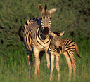
National flag has three colors; blue for water, white and black
represent the racial harmony of the people as well as the pluralist
nature of the society. They are inspired by the coat of the zebra,
the national animal. There is a law in Botswana which requires
government permission to be granted before the flag of Botswana
can be flown. The
National flag has three colors; blue for water, white and black
represent the racial harmony of the people as well as the pluralist
nature of the society. They are inspired by the coat of the zebra,
the national animal. There is a law in Botswana which requires
government permission to be granted before the flag of Botswana
can be flown. |
Economy
Botswana has maintained one of the world's highest
economic growth rates since its independence in 1966, transforming
it from one of the world's poorest countries to a middle-income country
today; however, growth has slowed to 4.7% in 2006. Per capita GDP is
$15,000 as of 2007.
Diamond mining has fueled much of the
expansion and currently accounts for over one-third of GDP and four-fifths
of export earnings. Tourism, financial services, subsistence farming,
and cattle raising are other key sectors. On the downside, the government
must deal with high rates of unemployment and poverty. Unemployment
officially was 23.8% in 2004, but unofficial estimates place it closer
to 40%. HIV/AIDS infection rates are the second highest in the world
and threaten Botswana's impressive economic gains. An expected leveling
off in diamond mining production overshadows long-term prospects.
The local currency is the Pula and Thebe
(100 thebe = 1 Pula). The word pula means
"rain" in the local Setswana dialect, but it also has a deeper
meaning pertaining to luck. Thebe is the word for "shield".
The staple foods of the local peoples is bogobe (sorghum meal) and beef,
but there are many other traditional foods which vary from tribe to tribe.
Recent historical exchange rates are
as follows: Pula per US dollar - 7.537 (12/31/2008); 6.067 (12/31/2007); 6.202 (12/31/2006); 5.525 (12/31/2005);
4.281 (12/31/2004); 4.433 (12/31/2003); 5.400 (12/31/2002); 6.309 (12/31/2001);
5.371 (12/31/2000); 4.651 (12/31/1999); 4.464 (12/31/1998); 3.814 (12/31/1997).
Climate  For
temperature and rainfall details in Maun, click African
Safari Weather For
temperature and rainfall details in Maun, click African
Safari Weather
Most of Botswana falls within
the tropics with a typical tropical climate - summer rains and dry,
mild winters. It has basically a flat topography with a mean elevation
of 1,000m. The annual rainfall is very low (500ml per annum) as most
of the country lies within the Kalahari Desert. There is rarely any
rain between April and October - the bulk falling in January and February.
Although much of Botswana is covered by
the Kalahari (the Kalahari sands extend over 84% of Botswana's surface
area), a huge expanse of semi-desert wilderness with very little surface
water, its more luxuriant northern regions provide sanctuary to vast herds
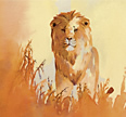
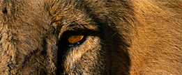
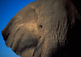
of indigenous wildlife, including one of the largest Elephant populations
on earth.
Underlying the sands is an ancient shallow basin of highly mineralised
rock strata in which pockets of fossil water can still be found. These
aquifers were fed from surface waters in a vast inland sea which once
covered most of Botswana (fed by the Zambezi, Okavango, Chobe and Linyanti
rivers). Tectonic activity shifted the rivers into the Indian Ocean and
the inland sea disappeared. The Okavango Delta is the remnant of this
sea.
Eighty percent of the country is Kalahari
scrub savannah grasslands and dry sandveld. The Okavango Delta is an oasis
within this desert.
Over 80% of the population live in the
far eastern strip of land between the Limpopo Valley and the low escarpment
(marking the eastern edge of the Kalahari Desert) in Francistown, Gabarone
and Selibe Pikwe. Only here are the rains sufficient and the soil qualities
adequate enough to support agriculture.
Conservation and Tourism
The government has set aside 17%
of its land as National Parks and Reserves plus an additional 22% as
Wildlife Management Areas. This foresight, along with strong conservation
policies and minimal population pressure, has given Botswana its unique
potential for future ecotourism.
Botswana's prime policy regarding tourism
is a high cost, low volume market. They do not wish to overexploit
their wildlife and wilderness resources with mass tourism as has happened
in much of East Africa. The government is committed to long-term gains,
with emphasis on uplifting its citizens through tourism and wildlife.
A system of 'concessions', or private
reserves, has been developed whereby the private sector may tender for
the sole use of a piece of land for periods of up to 15 years. The land
remains in the ownership of the country and its people and the private
sector may not own the land. Once a concession's lease has expired, the
concessions is put up for bids, and a rigorous process of evaluation is
conducted by an independent panel of experts who do not know the identity
of the companies submitting bids. Recommendations are then made to the
relevant committee of elected officials, which makes the final decisions
on who wins the tender. The winning operator is required to match the
highest rental bid by all tenderers. The system is designed to attract
the most competent operators, and to ensure that the local communities,
and the country, derive maximum benefit from the use of it's resources
for tourism.
Concession rental is paid to the Land
Boards; a resource royalty is paid to local government agencies; sales
tax on accommodation receipts, and a 25% income tax is paid to the central
government. A per-bednight training levy goes to the Tourism Department,
and daily game reserve entry fees for every visitor also go to the central
government. Concession operators also pay high annual fees for each vehicle,
aircraft and boat used within the Park. Operators also employ locals from
the area as guides and to help operate the camp, thus reinforcing the
policy of involving and benefiting the communities living in and around
the concessions and providing a culturally rich experience for the visitor.
Most of the prime wildlife areas in northern
Botswana outside of the game reserves and national parks have been divided
up into blocks of up to 200,000 hectares (440,000 acres) and allocated
to certain tourism activities and companies. These concessions are very
large, and their use is strictly controlled by the Wildlife Department
and the Tawana Land Board. Companies leasing the concessions must adhere
to strict guidelines designating the use of the 'leased' land. For example,
a particular concession may be allocated 20 beds and 45 kilometres of
game drive roads.
This is one of the most progressive tourism
systems in Africa, as concession 'holders' have a vested interest to ensure
that their area and wildlife is well looked after. This system effectively
gives the Botswana government full control over how much impact tourism
has on its natural areas and prevents greedy operators from overcrowding
concessions for personal gains.
The National Parks and Reserves in Botswana are a haven for wildlife and photographic safaris. Outside of the sanctuary of the reserves, Botswana is divided into parcels of land commonly referred to as concessions. Those in the Ngamiland District, which inlcudes the Okavango Delta and Linyanti / Selinda reserves, are identified by codes beginning with 'NG' and numbered NG1 to NG51. Read more...
International
Disputes
• The alignment of the boundary
with Namibia in the Kwando/Linyanti/Chobe River, including the Situngu
marshlands, was resolved amicably in 2003.
• Concerns
from international experts and local populations over the ecology of
the Okavango Delta in Botswana and human displacement scuttled Namibian
plans to construct a hydroelectric dam at Popavalle (Popa Falls) along
the Angola-Namibia border.
• Botswana has built
electric fences to stem the thousands of Zimbabweans who flee to find
work and escape political persecution.
• Namibia has long supported,
and in 2004 Zimbabwe dropped objections to, plans between Botswana
and Zambia to build a bridge over the Zambezi River, thereby de facto
recognizing the short, but not clearly delimited, Botswana-Zambia boundary.
Top
Return to Map of Botswana
Water
/ Land Activity Table for Botswana camps: Water/Land
Botswana
Flying
Times between Botswana camps: Fly
Times Botswana
For a map of Safari Camps in the Okavango Delta and Moremi Game
Reserve, click Okavango
Camps
For a map of Safari Camps in the Linyanti, Selinda, Kwando, and Chobe Game Reserve, click Chobe / Linyanti
Camps
For further information about the Okavango Delta, click More
Okavango
For further information about the Moremi Game Reserve, click More
Moremi
For further information about the Linyanti Wildlife Reserve, click More
Linyanti
For further information about the Chobe National Park, click More
Chobe
For
further information about the Tuli Region & Tuli Game Reserve,
click Tuli Information
|