Interactive Map of Overberg / Helderberg, Western Cape, South Africa
The Overberg and Helderberg
In the most southerly region of Africa, only one hour east of Cape Town,
lies the Fairest Cape's best kept secret, a fertile area surrounded by
mountains and sea. Simply called the Overberg, it is the traveller's
reward for breaching the mountain barriers which divide it from the rest
of the country. To early settlers it represented the land beyond the
mountains of Africa, a region rich in resources as well as boundless
treasures.
Overberg literally means 'over
the mountain' and it derives from the early settlers in Cape Town
who went over the mountains by ox and wagon to see what was on the
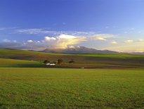
other side. They found a fertile coastal belt which now is intensively
farmed with fields of wheat and herds of sheep. Some considerate
farmers have even put signs up on the edges of their fields to tell
travellers what kind of crop they are looking at. The villages and
towns are all quite charming, some nestling amongst the mountain
ranges and others in lowland river valleys.
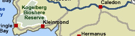
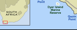
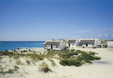
The Overberg coast, also called the Whale Coast, has the distinction
of splitting the oceans. At Cape Agulhas, the southernmost tip of the
continent, the waters are cleaved into the Indian and Atlantic Oceans.
The foothills of the mountains, covered in a wealth of indigenous fynbos,
roll down through green and gold wheat and sheep country to the lighthouse
here. Apart from the cry of seagulls and the endless beat of the surf
along a holiday-friendly shoreline - which also gives rest to the wreckage
of scores of luckless ships - silence prevails and solitude is easy
to find.
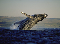
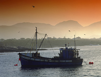
A scattering of tiny seaside resorts in the vicinity attract regular
caravanners, campers and fishermen. In contrast is Hermanus, a bustling
town where crowds flock to watch migrating whales between June and
November. The region offers visitors a myriad other activities, such
as golf, hiking,
birdwatching, canoeing, mountain biking, architectural tours, historical
tours, fynbos and flower trails and, of course, unending opportunities
to indulge in fine food and wine.
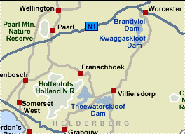
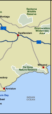
This superb coastal area, stretching from Hangklip to the mouth of the
Breede River, can be approached from the Cape Peninsula over the dramatic
Sir Lowry's Pass along the N2 national road, by a coastal road carved
from the sea cliffs from Gordon's Bay, through the Kogelberg Biosphere
- the only one in South Africa. The area can also be journeyed into from
other regions of the Western Cape Province such as the Winelands, the
Garden Route, the Breede River and the Klein Karoo.
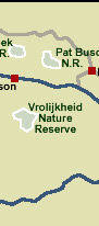
The Cape Helderberg, or Helderberg basin, includes the towns of Gordon's Bay, Sir Lowry's Pass, Somerset West, Macassar and Strand. The Hottentots Holland and Helderberg Mountain ranges provide a lovely backdrop against which the valley descends into picturesque vineyards and the spectacular False Bay coastline. The vast expanse of white, sandy beaches, warm water, cliffs and coves make the area a tourist and photographer's paradise. Less than 30 miles from Cape Town, the Helderberg is the gateway to the Overberg, Winelands and the Garden Route. The Helderberg also has its own wine route with over 20 estates, one of which is the historic Vergelegen in Somerset West.
 Top
Top  Return to Map
of Western Cape
Return to Map
of Western Cape
 Tour
the Cape: Cape
Town Tours Tour
the Cape: Cape
Town Tours
For
tourist information and activities in the
Overberg,
click More
Overberg
For
tourist information and activities in the Western Cape, click More
Western Cape
For further information about South Africa, click More
South Africa
|