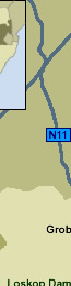
Interactive Map of Mpumalanga
Mpumalanga
Mpumalanga - which means 'place where the sun rises’- is one of South Africa’s tourism hotspots, loved by both local and international visitors for its beauty and diversity.
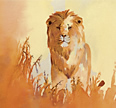
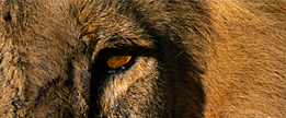
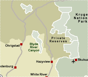
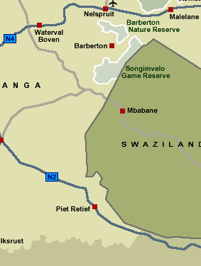
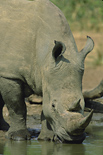
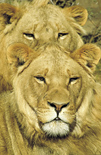
This province is home to the southern portion of Kruger National Park (‘big five’ country), exquisite panoramic views, mountains, rivers, trout fishing and birding opportunities, eco-tourism, adventure holidays and the rich offerings of the local Ndebele and Swazi cultures.
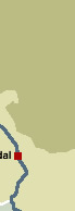
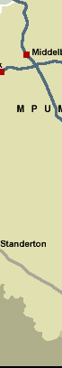
Mpumalanga is bordered by Mozambique and Swaziland in the east, and Gauteng in the west. It is situated mainly on the high plateau grasslands of the Middleveld, which roll eastwards for hundreds of kilometres.
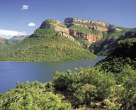
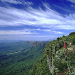
In the northeast, the land rises towards mountain peaks and then terminates in an immense escarpment. In some places, this escarpment plunges hundreds of metres down to the low-lying area known as the Lowveld.
Even though it is one of the smaller provinces (79 490 km2 in surface area), Mpumalanga is home to some three million people
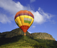
.As the safari capital of the country, the major draw-card to the area is the world-famous Kruger National Park. However, Mpumalanga has a lot more to offer than the ‘big five’ – the province is home to magnificent scenery and boasts a rich cultural heartland. Forests, pristine waters and trout fishing opportunities abound and there is no shortage of adventure activities, such as rock-climbing, abseiling, 4 x 4 trails, paragliding, kloofing and other high-adrenalin activities.
 Top
Top  Return to Map
of South Africa
Return to Map
of South Africa
 For
tourist information and activities in the
Mpumalanga Province, click More
Mpumalanga For
tourist information and activities in the
Mpumalanga Province, click More
Mpumalanga
For further information about Kruger National Park, click More
Kruger
For further information about South Africa, click More
South Africa
|